Sina'nın yüksek dağları: Azize Katerina, kadim bir manastır ve Bedevilerin rehberlik ettiği patikalar
Sina'nın sahil tatil köylerinin üzerinde Mısır'ın en yüksek toprakları yükseliyor: Musa Dağı ile Katerina Dağı, kapılarını hiç kapatmamış altıncı yüzyıldan kalma bir manastır, yüksek vadilerdeki Bedevi bahçeleri ve Bedevi kabilelerinin kurup bizzat rehberlik ettiği uzun mesafe yürüyüş rotası Sina Patikası.
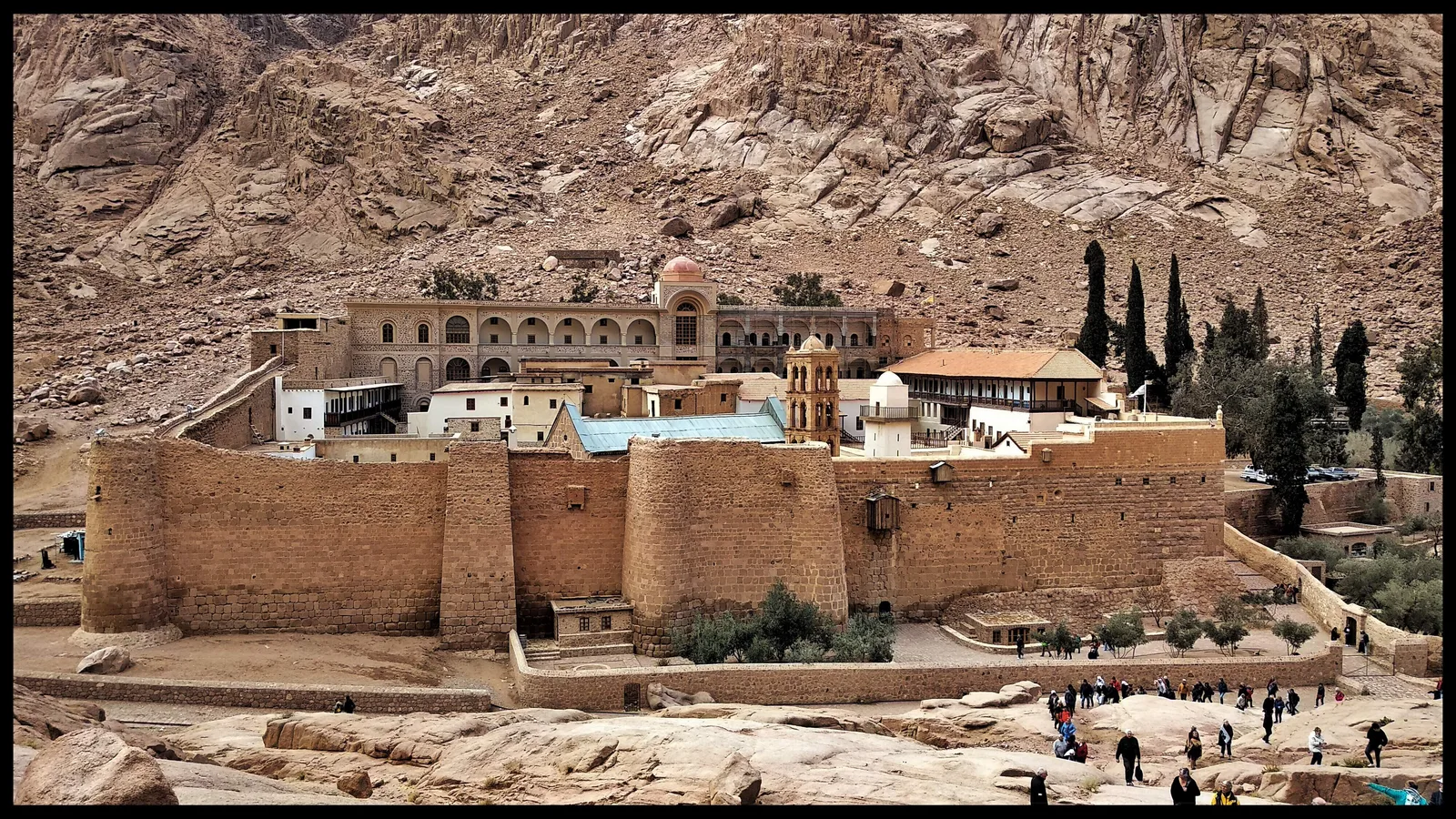
Sina'ya dair görüntülerin çoğu kıyıyı gösterir: Şarm El-Şeyh ve Dahab'ın tatil beldeleri, dalış iskeleleri, sahil kafeleri. Ne var ki yarımadanın iç kesimi bambaşka bir hikâye anlatır. Güneyde koyu granitten bir dağ düğümü Mısır'ın çatısına doğru yükselir; deniz seviyesinden yaklaşık 1.600 metre yukarıda ise küçük Aziz Katerina kasabası uzanır. Burası, yeryüzünde kesintisiz biçimde yerleşim görmüş en eski dinî mekânlardan birine çekilen hacıların, dağ yürüyüşçülerinin ve gezginlerin üssüdür.
Rakamlar sahneyi kuruyor. Kutsal kitaplarda geçen Sina Dağı'nın yeri olarak köklü geleneğin işaret ettiği zirve, yani Cebel Musa, yaklaşık 2.285 metre yükseliyor. Komşusu Katerina Dağı ise yaklaşık 2.642 metreyle bütün Mısır'ın en yüksek noktası. Buranın kışı gerçekten soğuk; kar zaman zaman zirveleri örtüyor ve bu manzara, Mısır'ı yalnızca çöl sıcağıyla anan ziyaretçileri şaşırtıyor. İlkbahar ile sonbahar ise yürüyüşçülerin en çok değer verdiği ılıman günleri ve yıldızlarla bezeli soğuk geceleri getiriyor.
Cebel Musa'nın eteğinde Aziz Katerina Manastırı yükselir. Surlarla berkitilmiş duvarları, Bizans İmparatoru Justinianus'un buyruğuyla altıncı yüzyılda inşa edildi ve Hristiyan geleneğinin çoktan Musa kıssasındaki yanan çalıyla ilişkilendirdiği bir alanı çevreledi. Granitten kale, uzak bir sınır bölgesindeki keşişleri korumak için tasarlanmıştı ve bunu olağanüstü bir başarıyla yaptı: manastır o günden bu yana kesintisiz olarak işlevini sürdürüyor; bu da onu dünyanın faaliyetteki en eski Hristiyan manastırlarından biri kılıyor.
Bu kesintisiz tarih, eşi benzeri olmayan bir miras bıraktı. Sıklıkla dünyanın kesintisiz çalışan en eski kütüphanelerinden biri olarak tanımlanan manastır kütüphanesi; Yunanca, Arapça, Süryanice, Gürcüce ve başka dillerde binlerce el yazması barındırıyor. Araştırmacılar on dokuzuncu yüzyılda, Hristiyan Kutsal Kitabı'nın günümüze ulaşan en eski kapsamlı nüshaları arasında sayılan dördüncü yüzyıl yazması Codex Sinaiticus'u burada saptadı; bugüne kalan yaprakların çoğu yurt dışında, başta British Library olmak üzere korunuyor. UNESCO 2002'de Aziz Katerina bölgesini Dünya Mirası Listesi'ne aldı.
Dağ, birden fazla din için kutsal topraktır. Manastır duvarlarının içinde bir cami bulunur; keşişler ise manastıra koruma vaat eden bir belge geleneğini, yani Hz. Muhammed'e atfedilen “Ahitname” belgesini muhafaza eder. Manastır cemaati, yüzyıllar boyunca değişen yönetimler karşısında bu geleneğe defalarca başvurdu. Yahudi, Hristiyan ve Müslüman yolcular yüzyıllardır bu yamaçlara tırmandı; bölgenin hikâyesi de çoğu zaman çetin bir coğrafyada uzun soluklu bir arada yaşamanın örneği olarak anlatılır.
Cebel Musa'ya tırmanış klasik deneyim olmayı sürdürüyor. Zirveye iki yol çıkıyor: geniş ve yumuşak eğimli uzun deve yolu ile, geleneğe göre bir keşişin yonttuğu söylenen yaklaşık 3.750 taş basamaklık “Tövbe Merdivenleri”. Ziyaretçilerin çoğu, çevredeki granit sıradağların siyahtan kırmızıya, oradan altın rengine döndüğü gün doğumunda zirveye varmak için karanlıkta yola çıkar. Zirveyi küçük bir kilise ile bir cami paylaşır; gündüz yapılan iniş ise el fenerleriyle tırmanılan yolun gerçek ölçeğini gözler önüne serer.
Bütün bunlar, tarihi manastırınkiyle iç içe geçmiş Bedevi aşireti Cebeliye olmadan mümkün olmazdı. Gelenek, atalarının yüzyıllar önce manastıra hizmet etmek ve onu korumak üzere gönderildiğini söyler; aşiret o günden bu yana Aziz Katerina çevresinde yaşıyor, yüksek vadilerde badem, zeytin ve meyve ağaçlarından oluşan, duvarlarla çevrili dağ bahçelerini işliyor. Rehberlik bugün yerel ekonominin temel direği hâline geldi ve yüksek dağlarda yürüyüş yapan ziyaretçilerin yanlarında yerli Bedevi rehberler bulundurması bekleniyor; bu kural hem yürüyüşçülerin güvenliğini hem de halkın geçimini koruyor.
Bu rehberlik geleneğinin en iddialı ifadesi, 2015'te Bedevi aşiretlerinden oluşan bir kooperatifin kurup işlettiği uzun mesafe yürüyüş rotası “Sina Patikası”dır. Özgün güzergâh, Akabe Körfezi kıyısını yaklaşık on iki günlük yürüyüşle Aziz Katerina yaylalarına bağlıyordu; proje daha sonra birçok aşiretin topraklarından geçen çok daha uzun bir ağa dönüştü ve her aşiret yolcuları kendi toprağından geçiriyor. Rota yaygın biçimde Mısır'ın ilk uzun mesafe yürüyüş yolu olarak anılıyor.
Dağların kendisi de koruma altındaki bir alan. Aziz Katerina Koruma Alanı, Mısır'da benzeri bulunmayan yüksek irtifalı bir ekosistemi kapsıyor; kış nemini tutan zirvelerde daha eski çağlardan kalma bitkiler yaşamayı sürdürüyor. Burada endemik türler tutunuyor; bunların arasında dünyanın en küçük kelebekleri sayılan ve yerel Sina kekiğine bağımlı olan “Sina mavisi” de var. Vadileri bahçeler, dağ keçileri ve yüzyıllık su kanalları paylaşıyor; buradaki koruma çabaları da bu manzarayı en başta biçimlendiren Bedevi bahçelerinden ayrı düşünülemiyor.
Yolculara pratik tavsiye ise basit: En yumuşak hava için ilkbaharda ya da sonbaharda gelin ve dağda geceleyecekseniz soğuk gecelere ciddi biçimde hazırlanın. Manastırda sade giyinin ve ziyaret saatlerini önceden öğrenin; bu saatler sınırlıdır ve manastırın takvimine göre belirlenir. Yerel rehberlerden yararlanın, çöpünüzü yanınızda geri getirin ve usulca yürüyün: bu dağlar bir fotoğraf fonu değil, yaklaşık on dört yüzyıldır bu toprakla kurdukları ahde sadık kalan keşişlerden ve Bedevilerden oluşan yaşayan bir topluluktur; bugün de buraya aynı saygıyla yaklaşan herkesi ağırlıyorlar.
İlgili Haberler
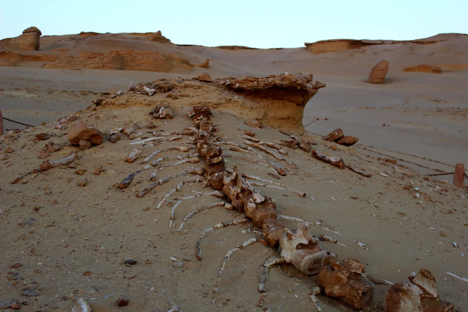
Vadi'ül-Hitan, Fayyum Bir Denizken: Kahire'den Kırk Milyon Yıllık Deniz Tabanına Bir Günlük Gezi
Kahire trafiğinden yaklaşık üç saat uzaklıkta, bir Mısırlı aile, 40 milyon yıl önce yaşamış, arka bacaklı bir balina iskeletinin önünde durur; bulundukları çöl bir zamanlar deniz tabanıydı. UNESCO, Vadi'ül-Hitan'ı Mısır'ın Dünya Mirası Listesi'ndeki ilk doğal alanı olarak neden seçti? Fosilleri, Vadi'r-Reyyan şelalelerini ve Tunus köyü çömlekçiliğini tek bir günde nasıl bir araya getirebilirsiniz? Vizesiz bir yolculuk için pratik bir rehber.
24 Eylül 2026 · 7 dk okuma
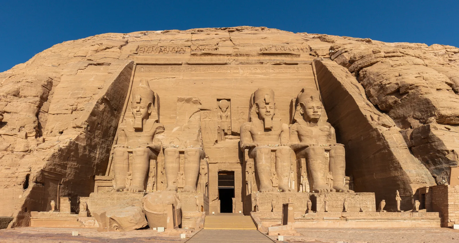
Ebu Simbel: İnsanlığın sular altında kalmasın diye 65 metre yukarı taşıdığı tapınak ve 22 Ekim'de ona geri dönen güneş
22 Ekim'de gün doğmadan kısa süre önce insanlar büyük salonun karanlığında, kayanın içinde yaklaşık altmış metre ilerleyip Ramses'in yüzünü aydınlatacak bir ışık huzmesini bekler. Bu anın ardında, tapınağı blok blok Nasır Gölü'nün sularının üzerine çıkaran yirmi yıllık bir uluslararası kampanyanın öyküsü var. Bu yazı, sahneyi anlamanız ve Asvan yolculuğunu tarihten bir ay önce planlamanız için rehberiniz.
20 Eylül 2026 · 7 dk okuma
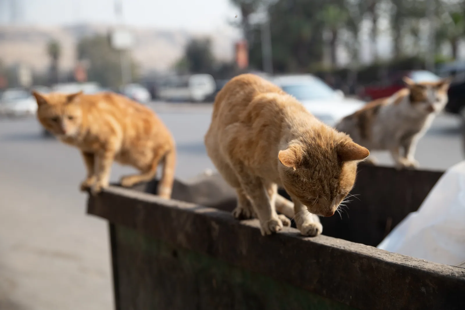
«Keda Ghalat» (Bu Yanlış): Kâsede Zehir, Sırtta Değnek — Hayvana Eziyet, 1937'den Beri Mısır Ceza Kanunu'nda Suç
Bir komşu okul duvarının yanına zehirli kaplar bırakıyor, bir araba sahibi ise eşeğine ağır bir yük çektirmek için yüzüne sopayla vuruyor. Birçok kişi «sadece bir hayvan»ı hiçbir kanunun korumadığını sanıyor. Oysa Ceza Kanunu'nun 355, 356 ve 357. maddeleri, hayvan öldürmeyi, zehirlemeyi ve ona eziyet etmeyi hapis cezasına varan yaptırımlarla cezalandırıyor. Dünya Hayvanlar Günü arifesinde kanunun ne dediğini açıklıyoruz.
3 Ekim 2026 · 6 dk okuma