Egipto en el espacio: una agencia nacional y satélites que vigilan la tierra, los cultivos y el agua
La Agencia Espacial Egipcia se creó por ley en 2018, pero la historia de Egipto con los satélites viene de antes: de EgyptSat-1 a Tiba-1 y NExSat. ¿Por qué necesita un país agrícola un programa espacial? La respuesta está en sus campos, su agua y sus aldeas remotas.
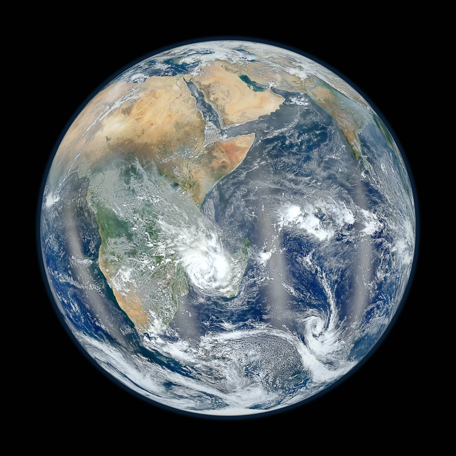
Un programa espacial puede parecer un lujo para un país cargado de problemas muy terrenales. La respuesta de Egipto ha sido exactamente la contraria: los satélites son herramientas de trabajo para esos mismos problemas, desde alimentar a la población hasta gestionar el agua y conectar a las comunidades aisladas. La Agencia Espacial Egipcia fue creada por una ley promulgada en 2018 y tiene su sede en la «Ciudad Espacial» de Nuevo Cairo, un complejo que alberga instalaciones para el montaje y el ensayo de satélites. Su cometido es arraigar la tecnología espacial en el país y poner sus productos, ante todo las imágenes y los datos, al servicio de los organismos civiles del Estado.
La historia satelital de Egipto comenzó antes de que existiera la agencia. EgyptSat-1, el primer satélite egipcio de observación de la Tierra, se lanzó en 2007 y se desarrolló en cooperación con la oficina de diseño ucraniana Yuzhnoye, con participación de ingenieros egipcios en los trabajos. Fotografió la superficie con fines científicos y civiles hasta que se perdió el contacto con él pocos años después. Aquella pérdida fue una lección temprana y dura, pero el proyecto ya había dejado una ganancia duradera: una generación de ingenieros egipcios que había recorrido el ciclo completo de especificar, construir y operar un satélite.
El segundo intento llegó con EgyptSat-2, construido junto a la industria rusa y lanzado en 2014, aunque su vida operativa también fue corta. Su sucesor, EgyptSat-A, despegó del cosmódromo de Baikonur a comienzos de 2019 con equipos de imagen mejorados y un diseño renovado. El patrón que dibujan estas tres misiones resulta familiar para todo país que ha levantado una capacidad espacial: los primeros satélites sirven tanto para formar personas y poner a prueba procedimientos como para enviar imágenes a la Tierra, y los reveses forman parte del precio del aprendizaje.
Después llegaron las comunicaciones. Tiba-1, lanzado en noviembre de 2019 a bordo de un cohete Ariane 5 desde Kourou, en la Guayana Francesa, fue construido para Egipto por fabricantes europeos y presta servicio a las comunicaciones gubernamentales y civiles. A diferencia del satélite de observación, que sobrevuela Egipto apenas unos minutos en cada órbita, el satélite de comunicaciones se asienta en la órbita geoestacionaria, a unos treinta y seis mil kilómetros de altura, y acompaña la rotación del planeta, de modo que parece fijo en el cielo. Desde ese punto puede llevar internet de banda ancha a lugares donde tender fibra óptica resulta lento o económicamente inviable.
El capítulo más reciente subraya la construcción en casa. MisrSat-2, satélite de observación de la Tierra desarrollado en cooperación con China y lanzado en diciembre de 2023, se ensambló y se probó con participación egipcia en instalaciones situadas dentro de Egipto. A comienzos de 2024 le siguió NExSat-1, un microsatélite de investigación desarrollado por la Agencia Espacial Egipcia con un socio alemán. El rumbo declarado no varía: pasar de comprar satélites a participar en su construcción y, después, a diseñarlos e integrarlos en el país, porque el valor duradero de un programa espacial está en las personas y en las instalaciones, no en una nave concreta.
¿Por qué necesita todo esto un país agrícola? Porque el satélite ve lo que ningún reconocimiento sobre el terreno alcanza a ver. Las cámaras multiespectrales registran la luz reflejada por los campos en bandas que escapan a la vista humana, y una planta sana refleja el infrarrojo de manera distinta a una planta sometida a estrés. Procesadas correctamente, las imágenes se convierten en mapas del tipo de cultivo, la superficie sembrada y el estado de la planta en todo el país, que se actualizan temporada tras temporada. Las autoridades egipcias han empleado además las imágenes de satélite para detectar construcciones ilegales sobre tierras agrícolas: un uso documentado en un país donde cada feddan del valle del Nilo cuenta.
El agua es el segundo gran uso. Egipto depende de forma abrumadora del Nilo, y los satélites vigilan el sistema fluvial de maneras que las estaciones terrestres no permiten: seguir la superficie del lago Nasser cuando sube y cuando baja, observar la erosión costera a lo largo del Delta, cartografiar lagos y humedales y apoyar la planificación del riego estimando cuánta agua consumen realmente los cultivos. Nada de esto sustituye a los ingenieros sobre el terreno; pero les da una mirada de conjunto que encierra todo el sistema en un solo marco y hace posibles la planificación y la alerta temprana.
Los satélites de comunicaciones cumplen un propósito distinto, aunque relacionado. Llevar conectividad a un asentamiento del desierto o a una ciudad nueva a través del espacio puede ser más rápido que extender las redes terrestres, y por eso la capacidad de Tiba-1 se orientó a los servicios públicos y a las zonas peor cubiertas. Egipto tiene además una tradición espacial más antigua e independiente: NileSat, la empresa cuyos satélites de difusión llevan televisión en árabe a toda la región desde 1998. La difusión televisiva y la banda ancha son negocios distintos, pero juntos muestran cuánta vida cotidiana pasa en silencio por la órbita.
Egipto ha asumido también un papel continental. La Ciudad Espacial de El Cairo acoge la sede de la Agencia Espacial Africana, el órgano de la Unión Africana encargado de coordinar la actividad espacial del continente y la primera institución panafricana de esta clase. Esa condición de anfitrión sitúa a Egipto en el centro del debate africano sobre el intercambio de datos satelitales para la agricultura, el clima y la respuesta a los desastres, y abre la puerta a formar a ingenieros de otros países africanos en instalaciones egipcias. La cooperación espacial, como la diplomacia de los ríos, es un terreno en el que la geografía y la historia conceden a Egipto un asiento natural.
La manera honesta de juzgar un programa espacial no es el número de lanzamientos, sino las decisiones. Cuando un responsable de riego redistribuye el agua a partir de mapas de consumo, cuando una gobernación detiene una construcción ilegal detectada desde la órbita, cuando un consultorio de una zona remota celebra una consulta médica por vídeo gracias a internet satelital, ese es el programa funcionando. Los satélites envejecen y se averían; la capacidad que permanece son personas capaces de especificar, construir, operar y, antes que nada, usar. Esa es la infraestructura que Egipto construye de verdad, y es tan real como cualquier carretera.
Noticias relacionadas
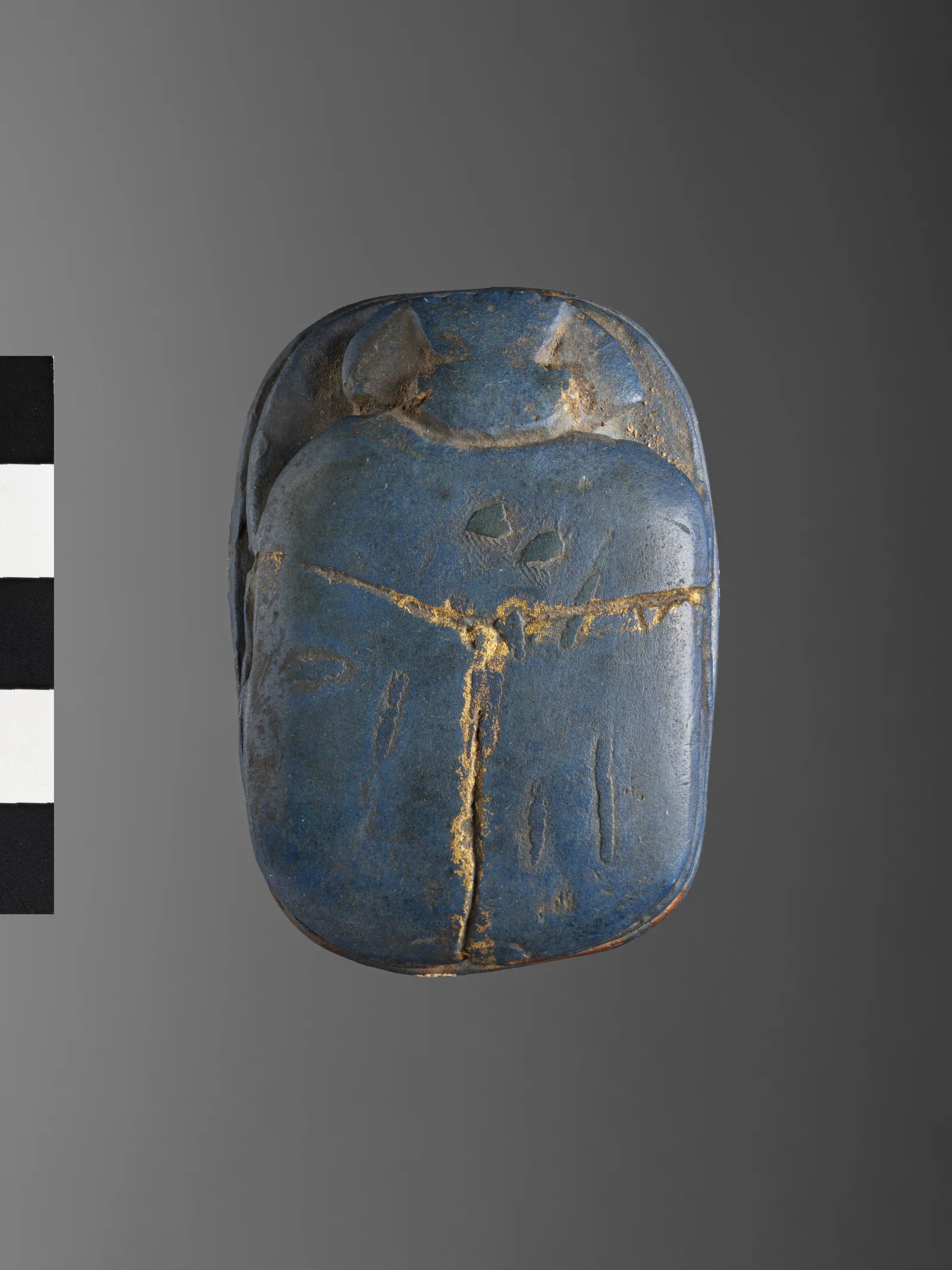
«Azul egipcio»: el primer pigmento sintético de la historia vuelve para revelar huellas dactilares e iluminar células
Un azul que químicos egipcios fabricaban con arena, cobre y cal hace miles de años resultó, en 2013, desintegrarse en láminas nanométricas que emiten luz infrarroja. Desde entonces se ha convertido en un polvo que revela huellas dactilares en Australia y en una sonda que ilumina embriones de mosca y hojas de plantas en Alemania. La historia de un material antiguo con una propiedad muy moderna, y una pregunta sobre nuestros laboratorios de hoy.
17 de septiembre de 2026 · 7 min de lectura
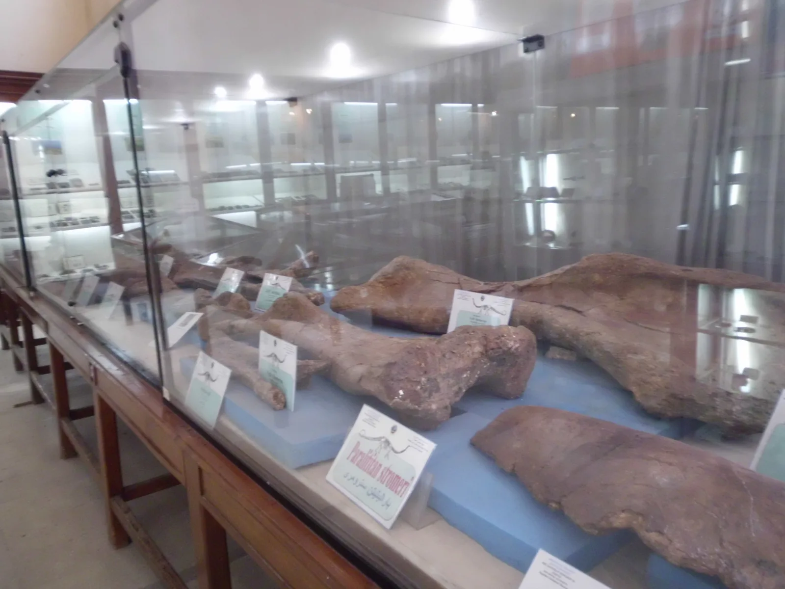
Ochenta millones de años antes de los faraones: el dinosaurio de Mansoura y los fósiles de los oasis que quemó la guerra
Estudiantes egipcios de la Universidad de Mansoura extrajeron de las rocas del oasis de Dakhla los huesos de Mansourasaurus, el esqueleto de dinosaurio del Cretácico superior más completo hallado en África. Un siglo antes, un científico alemán había depositado en Múnich los dinosaurios del oasis de Bahariya, y la guerra los quemó. La historia del archivo de la Tierra en el desierto de Egipto, y de una ciencia que su hijo puede estudiar aquí.
8 de septiembre de 2026 · 7 min de lectura
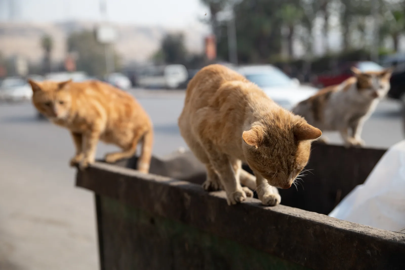
«Keda ghalat» («Esto está mal»): maltratar a un animal es un delito según el Código Penal egipcio desde 1937
Un vecino coloca platos envenenados junto al muro de la escuela; un carretero golpea a su burro en la cara bajo una carga excesiva. Muchos creen que «es solo un animal» y que ninguna ley lo protege. En realidad, los artículos 355, 356 y 357 del Código Penal castigan matar, envenenar y maltratar animales, con penas de hasta prisión. En vísperas del Día Mundial de los Animales, explicamos qué dice la ley.
3 de octubre de 2026 · 6 min de lectura